
Copernicus: September 1.63C above pre-industrial – record warmth in El Niño region
The EU climate service reports the second-warmest September in its dataset. In the Pacific, the Niño 3.4 region hit a record value, and the WMO says it could be one of the strongest El Niños since 1950.
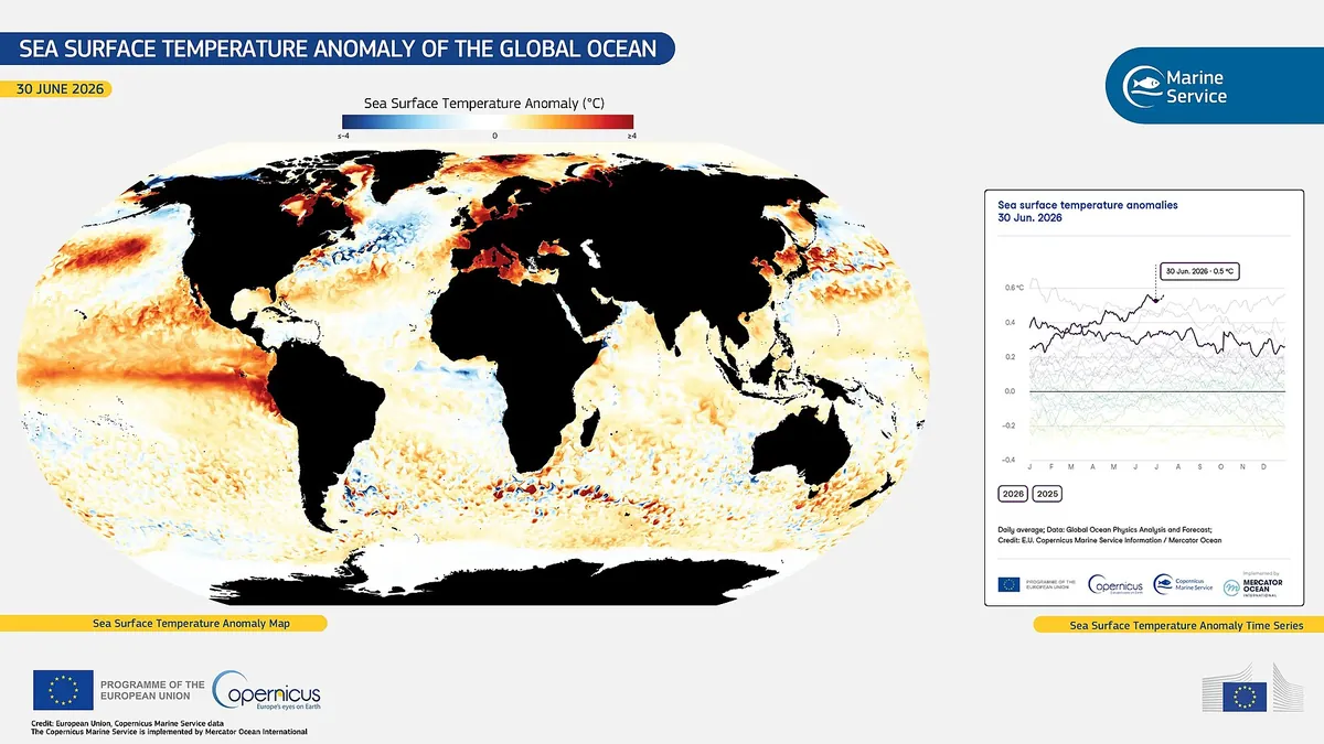
Archive image · Photo: Copernicus Marine Service Data, EK - GD DEFIS, EC - DG DEFIS, SPACETEC PARTNERS, CE - DG DEFIS / Wikimedia Commons, CC BY 4.0 (cropped and resized)
The Copernicus Climate Change Service (C3S) published its analysis for September 2026 on 12 October. Global mean surface air temperature was 16.27 degrees Celsius – 0.82 degrees above the 1991–2020 average and 1.63 degrees above the pre-industrial level of 1850–1900. It was the second-warmest September in the ERA5 dataset, 0.11 degrees cooler than the record September of 2023. August had already exceeded the 1.5-degree mark; before that, the last month to do so was November 2025. The average of the past twelve months (October 2025 to September 2026) reached 1.50 degrees, according to C3S.
Over European land, the average was 16.26 degrees, 1.54 degrees above the 1991–2020 average – third place. Western Europe had its joint-warmest September on record, tied with 2023; southern France, Portugal, Spain and parts of Italy were 4 to 6 degrees above average. Only the south-eastern Balkans and western Türkiye were slightly cooler than usual. Sea surface temperature between 60 degrees south and 60 degrees north reached 21.05 degrees, the highest value ever recorded for a September.
In the Pacific Niño 3.4 region, sea surface temperature reached an all-time high of 29.70 degrees, according to C3S; the anomaly of plus 2.99 degrees beats the previous record of 2.81 degrees set in December 1997. The World Meteorological Organization (WMO) expects El Niño to peak in December and, with near-100 per cent likelihood, to persist through February 2027. Context: the Copernicus figures are based on the ERA5 reanalysis, which combines observations with model calculations. The US agency NOAA, using its own dataset, also ranks the month as the second-warmest September. Individual months above 1.5 degrees do not mean the Paris 1.5-degree limit has been breached – it refers to long-term averages.